Skip to content

Cloudpermit Expands Its Software Suite with CityReporter Acquisition. Click Here to Read the Press Release

IT & GIS

Secure, cloud-based software that protects municipal data, works with your GIS, and connects to the systems your departments already rely on. 

Secure, Connected Software Your IT Team Can Stand Behind

When a department chooses new software, IT and GIS teams are the ones who have to secure it, connect it, and support it. In some municipalities, IT is its own department. In many others, it’s a small team, or a single person within finance or administration, responsible for every system in town hall. 

Cloudpermit combines U.S. data hosting, encryption, role-based permissions, and security monitoring with documented integration options. Property data tools and available APIs help departments work from consistent information and connect to other municipal systems. 
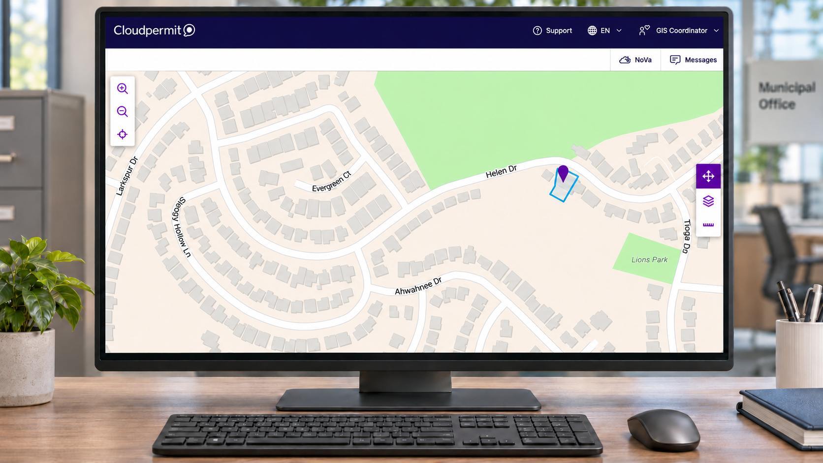
GIS connected software

Why IT and GIS Teams Choose Cloudpermit

  • Runs in a web browser on any operating system and mobile device
  • Mobile inspections app that works offline and syncs automatically 
  • Unlimited user licenses
  • Available in English, Spanish, and French
  • Integrations with supported ERP software, Laserfiche, Bluebeam, DigEplan, and ICC Code Connect
Why IT and GIS teams choose Cloudpermit

Get the details your team needs to evaluate Cloudpermit.
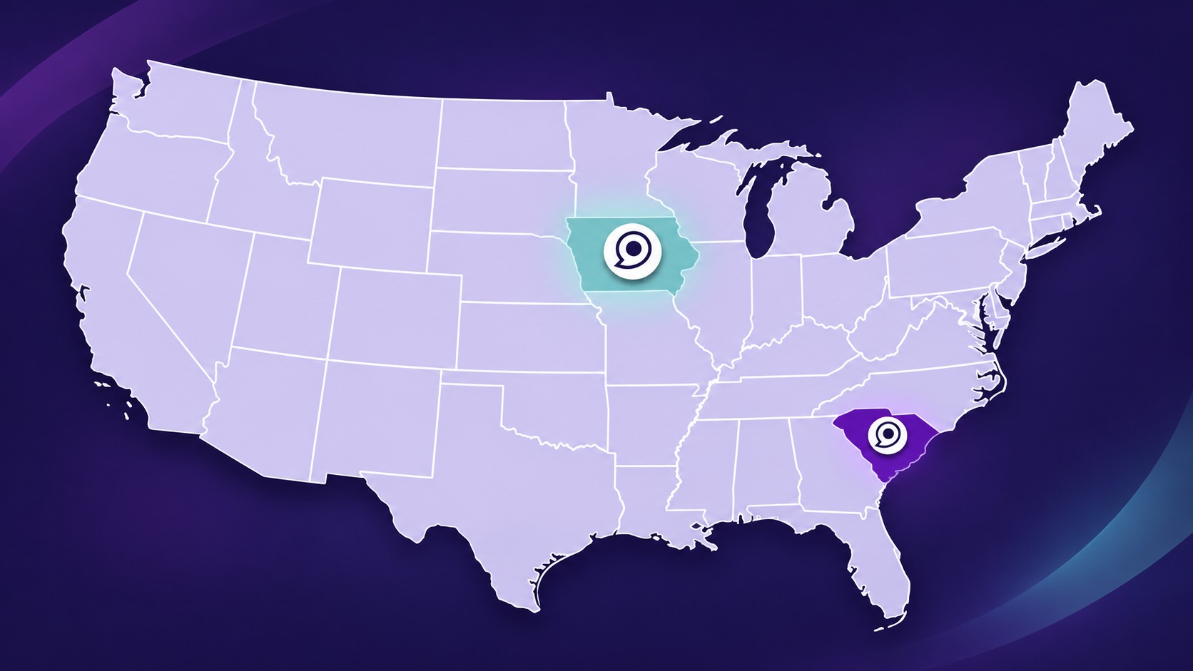
Know Where Your Data Lives

  • U.S. customer data is stored in Google Cloud regions in the United States
  • Primary infrastructure is in Iowa, with secondary infrastructure in South Carolina
  • U.S. customer data remains within U.S. infrastructure
  • Nightly incremental backups, plus continuous replication to a secondary U.S. region
  • Encrypted backups and an annual disaster recovery exercise
Download Brochure
Hosting & Data Residency

Multiple Layers of Protection

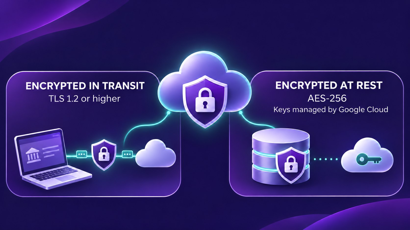
  • Data encrypted in transit with TLS 1.2 or higher
  • Data encrypted at rest with AES-256, using keys managed by Google Cloud
  • 24/7/365 security monitoring
  • Continuous third-party scanning for vulnerabilities
  • Independent third-party penetration testing of the application every year
Download Brochure
Security & Monitoring

Control Who Sees What

  • Role-based access and granular permissions, so users only see information appropriate to their role
  • Access controls enforced server-side for every action
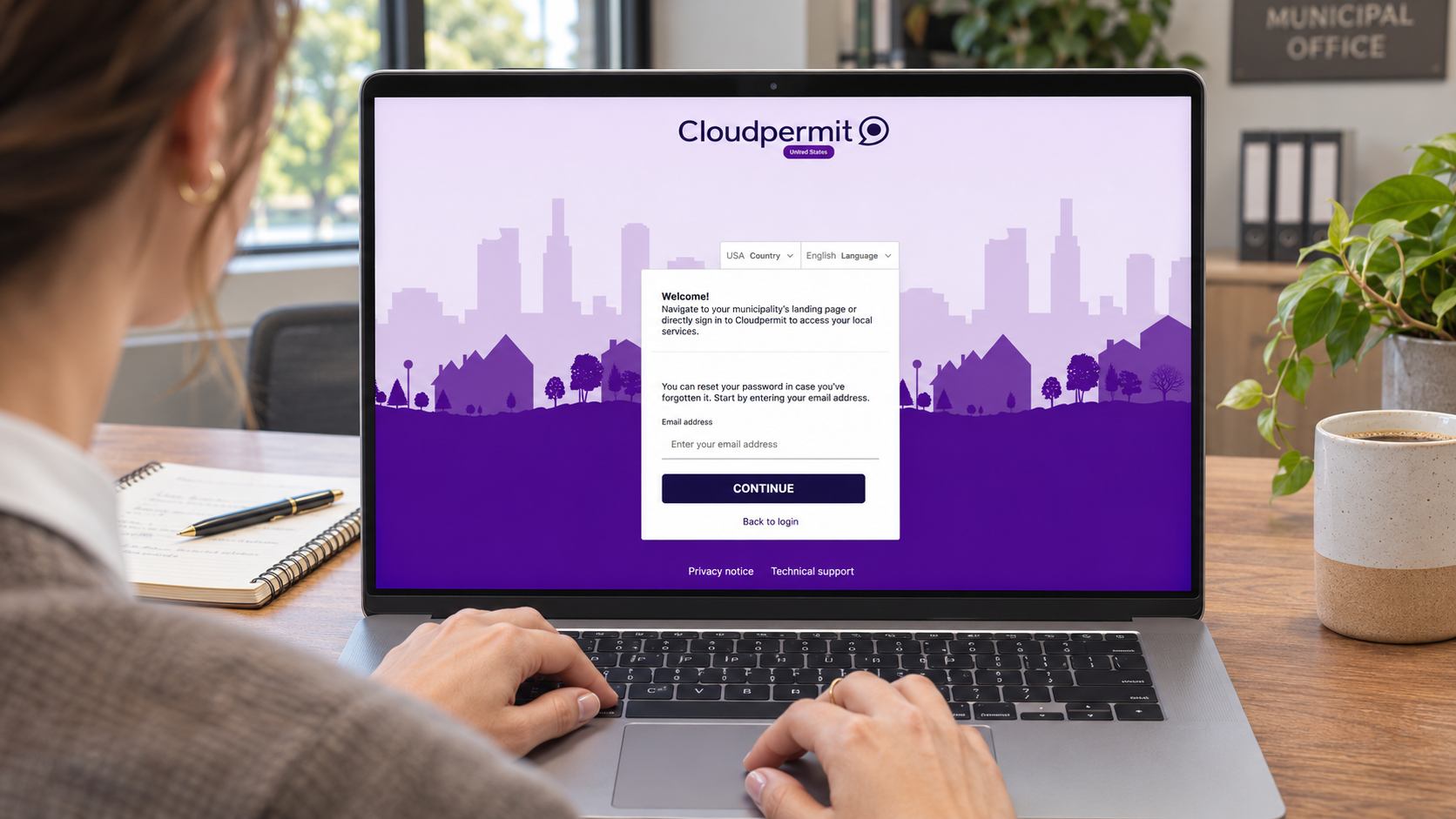
  • Single sign-on through OpenID Connect where available
  • Weak passwords rejected automatically
  • Cloudpermit staff access is need-to-know, periodically reviewed, and logged
  • A detailed audit trail records who changed data, when, and what it was before
Download Brochure
Access & Identity

Connect Cloudpermit to Your Existing Systems

  • REST API with JSON data, available for all Cloudpermit products
  • Workspaces, Attachments, Inspections, Property, and Payments APIs
  • Integrations with supported municipal ERP software and Laserfiche document management
  • Plan review integrations with Bluebeam and DigEplan, plus ICC Code Connect
  • Test supported integrations in a training environment before going live
  • Access additional APIs to connect Cloudpermit with your existing systems
Download Brochure
API - People with Puzzle Pieces

Use AI Without Losing Control of Your Data

  • AI features use Google Gemini and/or OpenAI through enterprise arrangements
  • Customer data submitted to these services can’t be used to train their foundation models
  • Data isn’t shared with other customers, and AI features don’t have blanket access to municipal databases
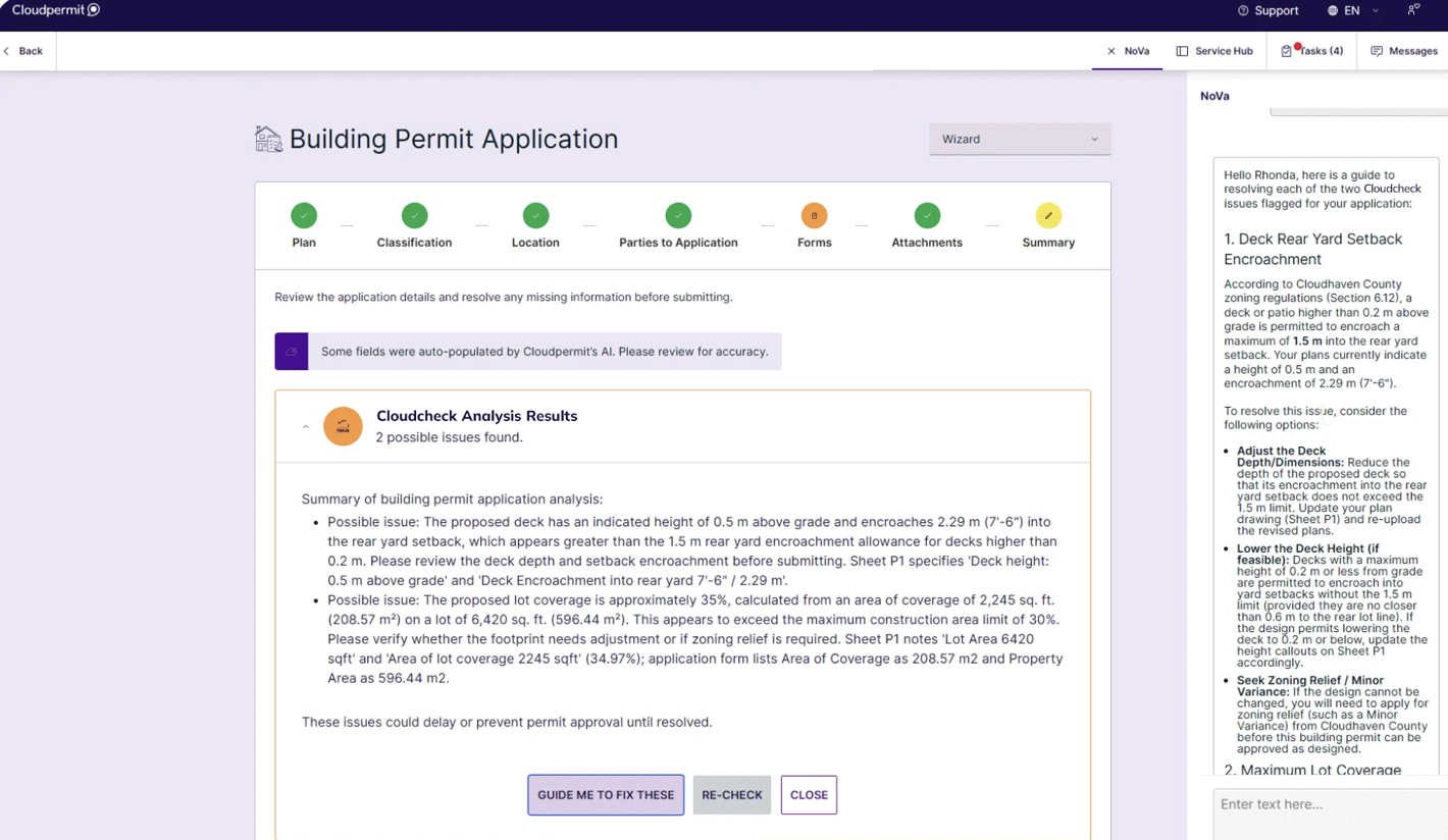
  • AI Cloudcheck flags potential application issues while staff keep decision-making authority
  • NoVa answers staff and resident questions using the municipal codes you choose to upload
Download Brochure
REUSE AI & Data Privacy

Build on the GIS Data You Already Have

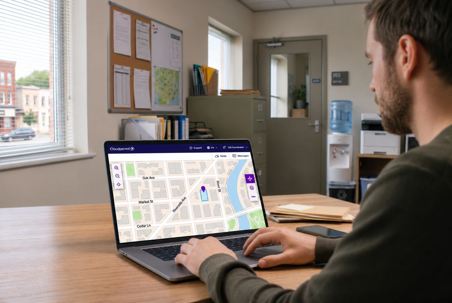
  • Import property, parcel, and unit records from your local GIS, and read property attributes by property ID through the Property API
  • Maintain local property details that aren’t in your GIS source data, without waiting for GIS updates
  • Apply property attributes such as flood zones and historic districts to permits and applications
  • Plan inspection and work routes using local GIS data
  • See supported infrastructure assets on a map so teams can locate and manage asset records by location
  • Import existing asset inventories from spreadsheets, including parent/child asset relationships, instead of entering each asset manually
Download Brochure
GIS

Property Data Management

Property Data Management

Import property, parcel, and unit records from your local GIS and keep them accurate with built-in verification workflows. 

Asset Management

Asset Management

Organize assets by type and location, see supported assets on a map, and import existing inventories from spreadsheets. 

Permitting

Permitting

Online permitting with GIS-integrated maps, configurable workflows, API access, and plan review and code integrations.

Planning & Zoning

Planning & Zoning

Use GIS map layers and property data to support application reviews, notification areas, and planning decisions. 

Inspections

Inspections

Mobile inspections that work offline, sync automatically, and use local GIS data for route planning.

Road & Highway Maintenance

Road & Highway Maintenance

Track point, mobile, and linear assets on an interactive map with local GIS data and live vehicle tracking. 

Less to Maintain, More to Rely On

Because Cloudpermit is cloud-hosted, your team doesn’t have to install servers, run backups, or schedule upgrades. Cloudpermit runs in a web browser on any operating system, with a mobile app for field staff, and unlimited user licenses mean you won’t have to ration accounts as more departments come on board. 

Where is Cloudpermit’s U.S. customer data stored?

Cloudpermit stores U.S. customer data in Google Cloud regions in the United States, with primary infrastructure in Iowa and secondary infrastructure in South Carolina. U.S. customer data remains within U.S. infrastructure. Cloudpermit performs nightly incremental backups and continuously replicates data to the secondary region. 

Community development in one place

How does Cloudpermit protect municipal data?

Cloudpermit encrypts data in transit with TLS 1.2 or higher and at rest with AES-256. Role-based permissions limit what each user can see, single sign-on is supported through OpenID Connect where available, and every change is recorded in an audit trail. Cloudpermit also runs 24/7/365 security monitoring and commissions independent penetration testing every year. 

Right of way public works permit

Does Cloudpermit integrate with our GIS?

Yes. Cloudpermit can import property, parcel, and unit records from your local GIS, and its Property API reads property attributes by property ID. Staff can maintain local property details that aren’t in your GIS without waiting for GIS updates, and map layers and local GIS data support reviews, routing, and field work. 

Create periodic inspection

How does Cloudpermit use AI with municipal data?

Cloudpermit’s AI features use Google Gemini and/or OpenAI through enterprise arrangements. Customer data submitted to these services can’t be used to train their foundation models or be shared with other customers, and AI features don’t have blanket access to municipal databases. Staff keep decision-making authority over applications. 

Property data configuration - attributes
1450
Customers
60
Citizens
Served
24
Permits Issued
32
On-Site Mobile Inspections Conducted
Cloudpermit