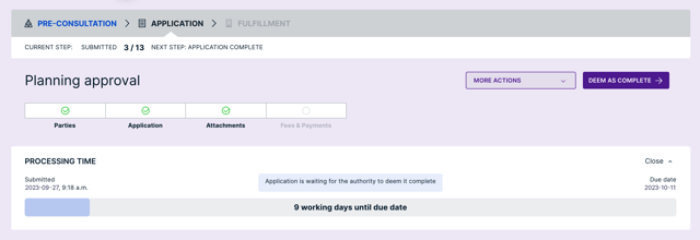
Planning Applications
Accept, review, and approve planning applications online.
- Force citizens to complete applications with necessary attachments and paid fees before they can click ‘submit’ with mandatory input fields
- Deem applications as complete
- Track, monitor, and receive planning application status updates
- Manage all required information, drawings, insurance documents, and other attachments in one workspace
- Collect secure applications
Land Use Permits
Accept and issue zoning, conditional use, and special use permits online for an end-to-end process.
AI Support Assistant
Ask questions and get instant help 24/7 from NoVa, our AI assistant for staff and citizens.
- Answer common questions in real time
- Guide users through applications and workflows
- Reduce support requests and calls
- Improve satisfaction for all users
- Route questions NoVa can’t answer to Cloudpermit Support
- Upload your own municipal codes to enable NoVa to answer questions about local regulations

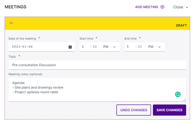
Meetings
Keep track of your meetings to approve planning applications faster.
- Manage pre-consultation requests
- Review past, upcoming, and proposed meetings
- Use templates to create agendas for planning commissions, boards, or council meetings
- Generate downloadable meeting packages that include relevant documents and agendas
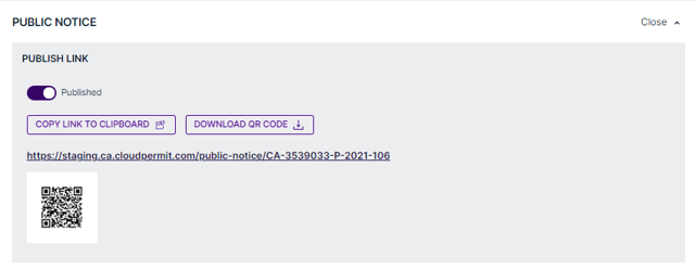
Public Notice
Engage with your public online.
- Record and inform interested parties with status updates on projects
- Allow citizens to automatically receive decisions on applications by registering through a link/QR code
- Generate an automated list of property owners within the required public notice radius
- Measure public opinion
- Upload documents as part of public notice notes such as opinion, opposition, or support letters
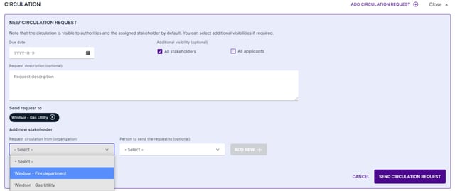
Circulation
Circulate applications in real-time to external and internal departments and agencies.
- Send multiple circulation requests at once
- Control commenting visibility
- Notify users via email when a new circulation request is made
- Receive all responses in one place
- Set due dates for circulation responses
- Circulate applications internally and externally to help determine whether applications can be deemed complete
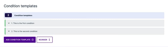
Conditions
Never miss an open condition.
- Access all open conditions in one property view
- Set default conditions for different types of applications
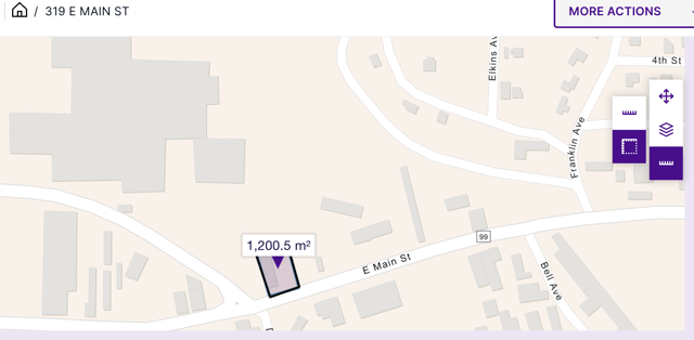
GIS Integrated Maps
Enjoy interactive maps online that are integrated with your GIS.
- Retrieve detailed and accurate property information
- Find neighboring properties, property owners, and contact information for public notice purposes
- Access different layers such as flooding maps, heritage areas, etc.
- Determine the distance between different points
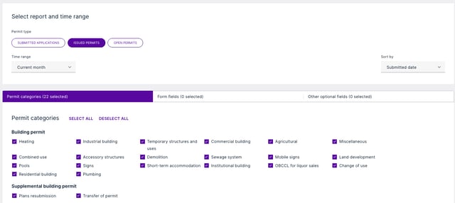
Reporting
Download reports in a few clicks.
- Create reports, such as for payments and reviews
- Select and filter application categories, form fields, and optional fields
- Download reports as an Excel or CSV file
- Create pre-sets to save commonly used reports
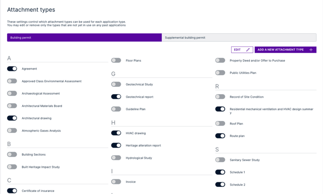
Configuration
Our team configures Cloudpermit to meet your needs.
- Change and modify workflows
- Receive support from trained department administrators
- Select application types from a pre-configured structure
- Use templates to create public notice agendas and templates, and other documents in PDF format
- Share planning applications with external departments, agencies, and third-party organizations
- Let stakeholder organizations manage their own reviewers and assignments
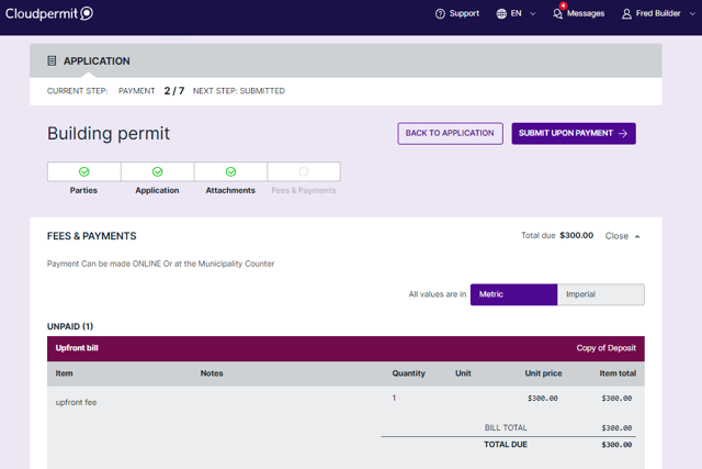
Payment
Accept secure payments online.
- Enable online and over-the-counter payments
- Integrate with third-party PCI compliant payment gateways
- Notify citizens when they have a due payment
- Create upfront application bills and bill drafts automatically
- Use an established escrow account to manage funds and pay for applications
Municipal Portal
Connect applicants, developers, and residents with planning services, project information, and municipal resources through one centralized portal.
- Submit planning and development applications online
- Track reviews, approvals, and application status
- Search projects, permits, and public records
- Access planning requirements and community information
- Receive AI-powered guidance through NoVa
- Customize municipal branding and messaging
- Improve transparency and public engagement

API Integration
Easily integrate data and services from third-party systems with our API (Application Programming Interface).
- Download attachments in a workspace and update metadata or upload new versions
- Access all inspections data and get inspectors’ work lists
- Get attributes by property ID read from your local GIS
- Get bills and fee items for a workspace
- Query workspaces and request data by property or workspace ID
